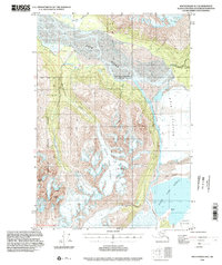
1994 Map of Anchorage B-5
USGS Topo · Published 2002About this map
Glacial dynamics and high-elevation terrain define this 1994 study of the Alaskan wilderness east of Anchorage. The Knik River valley serves as a primary drainage corridor, fed by massive ice fields including the Knik Glacier and Hunter Creek Glacier. The landscape is characterized by the interaction of ice and water, most notably where the Colony Glacier meets the waters of Inner Lake George. Dramatic elevation changes are marked by prominent summits like Bashful Peak and Mt Palmer, while the western portion of the sheet is protected within the Chugach State Park. The map also captures the administrative boundary between the Matanuska-Susitna Borough and the Municipality of Anchorage, illustrating how these massive natural features dictate local political geography.
Find a feature on this map
20 named features on this map. Tap any name to fly to it.
Don’t see what you’re looking for? This feature index may not catch every label — zoom into the map to look around manually.
Map Details
Editions of this 1994 Anchorage B-5 Map
This is the sole edition of this map. No revisions or reprints were ever made.
Other maps of this area

1951 · Anchorage
USGS Topo · 1:250,000

1951 · Anchorage C-6
USGS Topo · 1:63,360

1951 · Anchorage C-5
USGS Topo · 1:63,360

1952 · Anchorage C-5
USGS Topo · 1:63,360

1960 · Anchorage A-6
USGS Topo · 1:63,360

1960 · Anchorage B-6
USGS Topo · 1:63,360

1960 · Anchorage A-5
USGS Topo · 1:63,360

1960 · Anchorage A-4
USGS Topo · 1:63,360

1960 · Anchorage C-5
USGS Topo · 1:63,360

1960 · Anchorage B-5
USGS Topo · 1:63,360