
1960 Map of Anchorage B-5
USGS Topo · Published 1964About this map
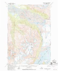
Mt Palmer stands as a central landmark in this Alaskan wilderness, surrounded by a complex system of ice and water as documented in the early 1960s. The landscape is defined by the massive Knik Glacier and Colony Glacier, which feed into an intricate drainage network. The Lake Fork the Knik River flows through a prominent gorge, connecting Upper Lake George and Inner Lake George toward the braided channels of the Knik River. These glacial movements and water levels reflect a dynamic environment before modern shifts, showing the proximity of features like Hunter Creek Glacier and the Low Ridge. This survey, based on aerial photography from the 1950s, details a terrain where waterways such as Friday Creek and Troublesome Creek intersect with high mountain peaks and deep glacial valleys.
Find a feature on this map
19 named features on this map. Tap any name to fly to it.
Don’t see what you’re looking for? This feature index may not catch every label — zoom into the map to look around manually.
Map Details
Editions of this 1960 Anchorage B-5 Map
3 editions found
Other maps of this area

1951 · Anchorage
USGS Topo · 1:250,000

1951 · Anchorage C-6
USGS Topo · 1:63,360

1951 · Anchorage C-5
USGS Topo · 1:63,360

1952 · Anchorage C-5
USGS Topo · 1:63,360

1960 · Anchorage A-6
USGS Topo · 1:63,360

1960 · Anchorage B-6
USGS Topo · 1:63,360

1960 · Anchorage A-5
USGS Topo · 1:63,360

1960 · Anchorage A-4
USGS Topo · 1:63,360

1960 · Anchorage C-5
USGS Topo · 1:63,360

1960 · Anchorage B-4
USGS Topo · 1:63,360