
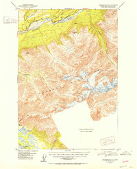
1952 Map of Anchorage C-5
USGS Topo · Published 1952About this map
The Matanuska River and the Glenn Highway carve a primary transit corridor through this high-altitude landscape in the early 1950s. This survey, based on 1949 aerial photography, documents the glacier-carved topography of the Chugach Mountains, where sharp peaks like Pinnacle Mtn and Kings Mtn overlook a network of drainage systems. The transport pattern is defined by the road and a parallel Trail that follows the river's northern bank toward the Kings River confluence.
Find a feature on this map
20 named features on this map. Tap any name to fly to it.
Don’t see what you’re looking for? This feature index may not catch every label — zoom into the map to look around manually.
Map Details
Editions of this 1952 Anchorage C-5 Map
2 editions found
Other maps of this area

1948 · Anchorage D-4
USGS Topo · 1:63,360

1949 · Anchorage D-5
USGS Topo · 1:63,360

1950 · Anchorage D-6
USGS Topo · 1:63,360

1951 · Anchorage
USGS Topo · 1:250,000

1951 · Anchorage C-6
USGS Topo · 1:63,360

1951 · Anchorage C-5
USGS Topo · 1:63,360

1952 · Anchorage D-6
USGS Topo · 1:63,360

1952 · Anchorage D-5
USGS Topo · 1:63,360

1952 · Anchorage D-4
USGS Topo · 1:63,360

1960 · Anchorage B-6
USGS Topo · 1:63,360