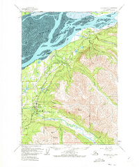
1960 Map of Anchorage B-7
USGS Topo · Published 1973About this map
Eagle River and its surrounding communities are documented here during a period of mid-century growth along the Glenn Highway corridor. The map details a transition from the tidal mudflats of the Knik Arm to the high peaks of the Chugach Mountains, including Mt Magnificent and Mt Eklutna. Along the coast, the Alaska Railroad parallels the shoreline, serving key points like the Birchwood Auxiliary Airfield and the settlement of Eklutna.
Find a feature on this map
44 named features on this map. Tap any name to fly to it.
Don’t see what you’re looking for? This feature index may not catch every label — zoom into the map to look around manually.
Map Details
Editions of this 1960 Anchorage B-7 Map
4 editions found


Other maps of this area

1950 · Anchorage C-8
USGS Topo · 1:63,360

1950 · Anchorage C-7
USGS Topo · 1:63,360

1951 · Anchorage
USGS Topo · 1:250,000

1951 · Anchorage C-6
USGS Topo · 1:63,360

1951 · Anchorage C-7
USGS Topo · 1:63,360

1952 · Anchorage C-7
USGS Topo · 1:63,360

1952 · Anchorage C-8
USGS Topo · 1:63,360

1952 · Anchorage A-8
USGS Topo · 1:63,360

1952 · Anchorage B-8
USGS Topo · 1:63,360

1953 · Anchorage A-8
USGS Topo · 1:63,360