
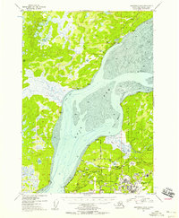
1953 Map of Anchorage B-8
USGS Topo · Published 1954About this map
The Iditarod Trail cuts a historic path through the northern landscape of this map, passing through the settlement of Knik near Knik Lake. This region at the head of the Knik Arm reveals a transition from the wilderness of Stephan Lake and Fish Creek to the military and industrial developments of the mid-20th century. South of the wide mudflats of Eagle Bay, the landscape is dominated by the sprawling infrastructure of Elmendorf Air Force Base and Fort Richardson.
Find a feature on this map
60 named features on this map. Tap any name to fly to it.
Don’t see what you’re looking for? This feature index may not catch every label — zoom into the map to look around manually.
Map Details
Editions of this 1953 Anchorage B-8 Map
2 editions found
Other maps of this area

1949 · Tyonek
USGS Topo · 1:250,000

1950 · Anchorage C-8
USGS Topo · 1:63,360

1950 · Anchorage C-7
USGS Topo · 1:63,360

1951 · Anchorage
USGS Topo · 1:250,000

1951 · Tyonek
USGS Topo · 1:250,000

1951 · Anchorage C-7
USGS Topo · 1:63,360

1951 · Tyonek A-1
USGS Topo · 1:63,360

1952 · Anchorage C-7
USGS Topo · 1:63,360

1952 · Anchorage C-8
USGS Topo · 1:63,360

1952 · Tyonek C-1
USGS Topo · 1:63,360