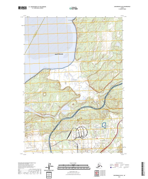
2023 Map of Anchorage B-8 SE
USGS Topo · Published 2023About this map
Joint Base Elmendorf-Richardson and its extensive military infrastructure dominate this 2023 landscape northeast of downtown Anchorage. The map detail reveals the modern footprint of Elmendorf Air Force Base and Bryant Army Airfield, alongside the Fort Richardson National Cemetery. Coastal features along the Knik Arm are prominent, including the tidal marshlands of the Eagle River Flats and the sheltered waters of Eagle Bay. Interior terrain is characterized by numerous small bodies of water such as Otter Lake, Lake Beebe, and Lake Kiowa. The complex road network within the base, featuring routes like Rte Bravo and Roosevelt Rd, highlights the area's primary function as a strategic hub. Geographic names like K'el Taydegit offer insight into the indigenous naming conventions and natural history of this subarctic environment near the mouth of the Eagle River.
Find a feature on this map
64 named features on this map. Tap any name to fly to it.
Don’t see what you’re looking for? This feature index may not catch every label — zoom into the map to look around manually.
Map Details
Editions of this 2023 Anchorage B-8 SE Map
This is the sole edition of this map. No revisions or reprints were ever made.
Other maps of this area

1951 · Anchorage
USGS Topo · 1:250,000

1952 · Anchorage A-8
USGS Topo · 1:63,360

1952 · Anchorage B-8
USGS Topo · 1:63,360

1953 · Anchorage A-8
USGS Topo · 1:63,360

1953 · Anchorage B-8
USGS Topo · 1:63,360

1960 · Anchorage B-7
USGS Topo · 1:63,360

1960 · Anchorage A-7
USGS Topo · 1:63,360

1962 · Anchorage
USGS Topo · 1:250,000

1965 · Anchorage B-8
USGS Topo · 1:63,360

1979 · Anchorage B-7 SW
USGS Topo · 1:25,000