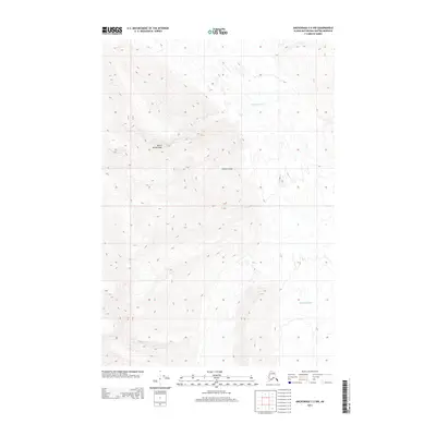
2013 Map of Anchorage C-2 NW
USGS Topo · Published 2013About this map
Matanuska Glacier dominates the northern and southeastern portions of this landscape within the Matanuska-Susitna Borough. This 2013 survey illustrates the complex glacial topography of the Chugach Mountains region, where massive ice fields shape the drainage patterns of the terrain. High-elevation peaks such as Mount Wickersham rise above the surrounding ice, providing distinct vertical relief alongside named landmarks like Glacier Point. The map provides a precise look at the township and range divisions, specifically the intersection of T 19 N and T 18 N, as they overlay this largely roadless and glaciated wilderness. For those studying the geomorphology of Alaska's interior or the historical extent of glacial movement, these contour details offer a rigorous record of the land surface before further environmental shifts.
Find a feature on this map
5 named features on this map. Tap any name to fly to it.
Don’t see what you’re looking for? This feature index may not catch every label — zoom into the map to look around manually.
Map Details
Editions of this 2013 Anchorage C-2 NW Map
This is the sole edition of this map. No revisions or reprints were ever made.
Other maps of this area

1948 · Anchorage D-3
USGS Topo · 1:63,360

1948 · Anchorage D-2
USGS Topo · 1:63,360

1951 · Anchorage
USGS Topo · 1:250,000

1952 · Anchorage D-2
USGS Topo · 1:63,360

1952 · Anchorage D-3
USGS Topo · 1:63,360

1960 · Anchorage C-2
USGS Topo · 1:63,360

1960 · Anchorage C-3
USGS Topo · 1:63,360

1962 · Anchorage
USGS Topo · 1:250,000
1976 · Anchorage D-2
USGS Topo · 1:63,360

1979 · Anchorage
USGS Topo · 1:250,000