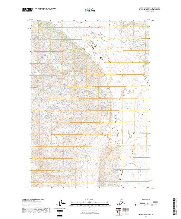
2023 Map of Anchorage C-2 NW
USGS Topo · Published 2023About this map
Mt Wickersham and Glacier Point dominate this high-elevation landscape in the Matanuska-Susitna Borough. This portion of the Anchorage C-2 NW quadrangle reveals a terrain defined by steep contours and significant glacial landforms, showing the transition between alpine peaks and the underlying geological structures of the Chugach Mountains. The map provides a detailed view of the natural topography in the early 21st century, focusing on the literal heights of the Alaskan wilderness where natural landmarks like Glacier Point serve as the primary navigational and descriptive points of reference. The absence of roads and settlements emphasizes the remote, undeveloped character of this specific quadrant of the interior.
Find a feature on this map
6 named features on this map. Tap any name to fly to it.
Don’t see what you’re looking for? This feature index may not catch every label — zoom into the map to look around manually.
Map Details
Editions of this 2023 Anchorage C-2 NW Map
This is the sole edition of this map. No revisions or reprints were ever made.
Other maps of this area

1948 · Anchorage D-3
USGS Topo · 1:63,360

1948 · Anchorage D-2
USGS Topo · 1:63,360

1951 · Anchorage
USGS Topo · 1:250,000

1952 · Anchorage D-2
USGS Topo · 1:63,360

1952 · Anchorage D-3
USGS Topo · 1:63,360

1960 · Anchorage C-2
USGS Topo · 1:63,360

1960 · Anchorage C-3
USGS Topo · 1:63,360

1962 · Anchorage
USGS Topo · 1:250,000
1976 · Anchorage D-2
USGS Topo · 1:63,360

1979 · Anchorage
USGS Topo · 1:250,000