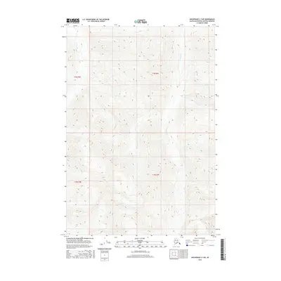
2016 Map of Anchorage C-3 NE
USGS Topo · Published 2016About this map
High-altitude glacial terrain dominates this northern landscape within the t19n r9e and t18n r9e townships of the Matanuska-Susitna Borough. The drainage of Glacier Cr carves through the steep mountain slopes, which reach elevations well above 6,000 feet as indicated by the tight contour intervals. This 2016 survey illustrates a largely untouched wilderness area where the topographic relief is the primary feature of the land. With no roads or settlements printed on the map, the focus remains on the hydrologic patterns and the severe verticality of the peaks, providing a clear record of the physical geography of the Alaskan interior in the early 21st century.
Find a feature on this map
5 named features on this map. Tap any name to fly to it.
Don’t see what you’re looking for? This feature index may not catch every label — zoom into the map to look around manually.
Map Details
Editions of this 2016 Anchorage C-3 NE Map
This is the sole edition of this map. No revisions or reprints were ever made.
Other maps of this area

1948 · Anchorage D-3
USGS Topo · 1:63,360

1948 · Anchorage D-2
USGS Topo · 1:63,360

1951 · Anchorage
USGS Topo · 1:250,000

1952 · Anchorage D-2
USGS Topo · 1:63,360

1952 · Anchorage D-3
USGS Topo · 1:63,360

1960 · Anchorage C-2
USGS Topo · 1:63,360

1960 · Anchorage C-3
USGS Topo · 1:63,360

1962 · Anchorage
USGS Topo · 1:250,000
1976 · Anchorage D-2
USGS Topo · 1:63,360

1979 · Anchorage
USGS Topo · 1:250,000