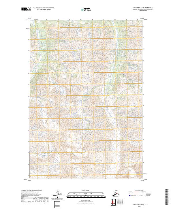
2023 Map of Anchorage C-3 NE
USGS Topo · Published 2023About this map
High-elevation glacial valleys and steep ridgelines define this portion of the Matanuska-Susitna Borough. The drainage of Gravel Creek flows northward along the western edge of the sheet, while Glacier Creek carves a path through the eastern terrain. This landscape is primarily shaped by natural topography, with no permanent human settlements or structures noted in the immediate vicinity. The map provides a detailed view of the Public Land Survey System boundaries, delineating townships like t19n r8e and t18n r9e. These divisions illustrate how the remote Alaskan interior was partitioned into the modern grid system, even in areas where the terrain remains largely untouched by development or road networks.
Find a feature on this map
6 named features on this map. Tap any name to fly to it.
Don’t see what you’re looking for? This feature index may not catch every label — zoom into the map to look around manually.
Map Details
Editions of this 2023 Anchorage C-3 NE Map
This is the sole edition of this map. No revisions or reprints were ever made.
Other maps of this area

1948 · Anchorage D-3
USGS Topo · 1:63,360

1948 · Anchorage D-2
USGS Topo · 1:63,360

1951 · Anchorage
USGS Topo · 1:250,000

1952 · Anchorage D-2
USGS Topo · 1:63,360

1952 · Anchorage D-3
USGS Topo · 1:63,360

1960 · Anchorage C-2
USGS Topo · 1:63,360

1960 · Anchorage C-3
USGS Topo · 1:63,360

1962 · Anchorage
USGS Topo · 1:250,000
1976 · Anchorage D-2
USGS Topo · 1:63,360

1979 · Anchorage
USGS Topo · 1:250,000