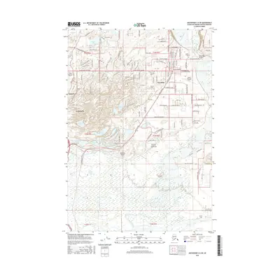
2016 Map of Anchorage C-6 SW
USGS Topo · Published 2016About this map
The Palmer township and the broader Matanuska Valley are the central focus of this 2016 survey, showcasing a landscape defined by its agricultural roots and expanding aviation infrastructure. The town's layout is clearly visible, with primary corridors like Colony Way and Alaska Street intersecting the street grid near the Palmer Pioneer Cem. The surrounding terrain is heavily influenced by the braided channels of the Matanuska River and an extensive network of kettle lakes, including Gooding Lake, Wasilla Creek, and Matanuska Lake.
Find a feature on this map
134 named features on this map. Tap any name to fly to it.
Don’t see what you’re looking for? This feature index may not catch every label — zoom into the map to look around manually.
Map Details
Editions of this 2016 Anchorage C-6 SW Map
This is the sole edition of this map. No revisions or reprints were ever made.
Other maps of this area

1950 · Anchorage C-7
USGS Topo · 1:63,360

1951 · Anchorage
USGS Topo · 1:250,000

1951 · Anchorage C-6
USGS Topo · 1:63,360

1951 · Anchorage C-7
USGS Topo · 1:63,360

1952 · Anchorage C-7
USGS Topo · 1:63,360

1960 · Anchorage B-7
USGS Topo · 1:63,360

1960 · Anchorage B-6
USGS Topo · 1:63,360

1962 · Anchorage
USGS Topo · 1:250,000

1979 · Anchorage B-6 NW
USGS Topo · 1:25,000
1979 · Anchorage C-7 NE
USGS Topo · 1:25,000