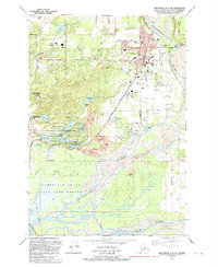
1992 Map of Anchorage C-6 SW
USGS Topo · Published 1992About this map
Palmer serves as the focal point of this 1990s-era survey, positioned where the Matanuska River valley meets the expansive Palmer Hay Flats. The town's institutional character is well-defined, featuring the Municipal Airport, the Tsunami Warning Center, and several academic sites including the University of Alaska Experimental Farm and Matanuska-Susitna Community College. Evidence of the area's agricultural and transit history is visible in the Old Railroad Grade and the Palmer Pioneer Cemetery near the town center.
Find a feature on this map
61 named features on this map. Tap any name to fly to it.
Don’t see what you’re looking for? This feature index may not catch every label — zoom into the map to look around manually.
Map Details
Editions of this 1992 Anchorage C-6 SW Map
This is the sole edition of this map. No revisions or reprints were ever made.
Other maps of this area

1950 · Anchorage C-7
USGS Topo · 1:63,360

1951 · Anchorage
USGS Topo · 1:250,000

1951 · Anchorage C-6
USGS Topo · 1:63,360

1951 · Anchorage C-7
USGS Topo · 1:63,360

1952 · Anchorage C-7
USGS Topo · 1:63,360

1960 · Anchorage B-7
USGS Topo · 1:63,360

1960 · Anchorage B-6
USGS Topo · 1:63,360

1962 · Anchorage
USGS Topo · 1:250,000

1979 · Anchorage B-6 NW
USGS Topo · 1:25,000
1979 · Anchorage C-7 NE
USGS Topo · 1:25,000