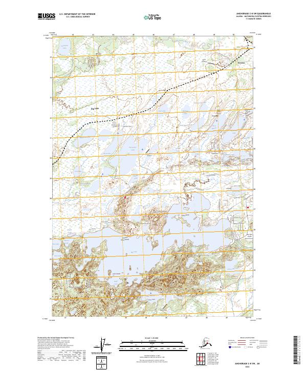
2023 Map of Anchorage C-8 SW
USGS Topo · Published 2023About this map
The Little Susitna River meanders through the northern reaches of this Matanuska-Susitna landscape, a region defined by an intricate network of waterways and small-scale aviation. The southern half of the map is dominated by Big Lake, featuring residential clusters and access points like Big Lake Airport and Reids Landing. The density of private airstrips, including Kucera Residence Airport, Kramer Airport, and Owen Field, highlights the area’s reliance on bush flying for local connectivity.
Find a feature on this map
98 named features on this map. Tap any name to fly to it.
Don’t see what you’re looking for? This feature index may not catch every label — zoom into the map to look around manually.
Map Details
Editions of this 2023 Anchorage C-8 SW Map
This is the sole edition of this map. No revisions or reprints were ever made.
Other maps of this area

1949 · Tyonek
USGS Topo · 1:250,000

1950 · Anchorage C-8
USGS Topo · 1:63,360

1951 · Anchorage
USGS Topo · 1:250,000

1951 · Tyonek
USGS Topo · 1:250,000

1952 · Anchorage C-8
USGS Topo · 1:63,360

1952 · Tyonek C-1
USGS Topo · 1:63,360

1952 · Anchorage B-8
USGS Topo · 1:63,360

1953 · Anchorage B-8
USGS Topo · 1:63,360

1958 · Tyonek B-1
USGS Topo · 1:63,360

1958 · Tyonek C-1
USGS Topo · 1:63,360