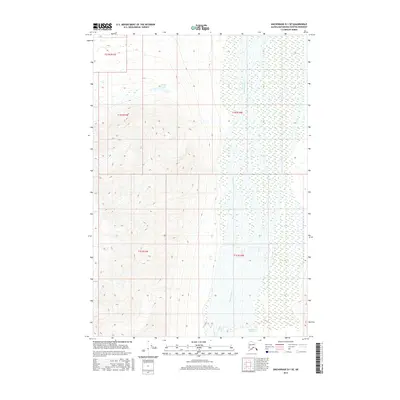
2016 Map of Anchorage D-1 SE
USGS Topo · Published 2016About this map
Nelchina River winds through this expanse of the Matanuska-Susitna Borough, defining a landscape dominated by glacial action and high-elevation hydrology. The river is fed by the massive Nelchina Glacier situated in the southeastern portion of the map, illustrating the direct relationship between the region's ice fields and its drainage systems. To the north, Goober Lake sits as a lonely water body amidst a complex network of township and range lines, including t21n r12e and t1n r11w. This survey captures the area in a state of natural transition, where topographic contours reveal the steep, unnamed ridges that flank the glacial valleys. The absence of roads or permanent settlements emphasizes the character of this Alaskan interior, where the land is primarily organized by the Public Land Survey System grid and the raw flow of glacial meltwater.
Find a feature on this map
8 named features on this map. Tap any name to fly to it.
Don’t see what you’re looking for? This feature index may not catch every label — zoom into the map to look around manually.
Map Details
Editions of this 2016 Anchorage D-1 SE Map
This is the sole edition of this map. No revisions or reprints were ever made.
Other maps of this area

1948 · Anchorage D-1
USGS Topo · 1:63,360

1949 · Valdez D-8
USGS Topo · 1:63,360

1951 · Anchorage
USGS Topo · 1:250,000

1951 · Anchorage D-1
USGS Topo · 1:63,360

1952 · Valdez D-8
USGS Topo · 1:63,360

1952 · Valdez
USGS Topo · 1:250,000

1960 · Valdez C-8
USGS Topo · 1:63,360

1960 · Anchorage C-1
USGS Topo · 1:63,360

1960 · Valdez
USGS Topo · 1:250,000

1962 · Anchorage
USGS Topo · 1:250,000