
1960 Map of Anchorage C-1
USGS Topo · Published 1966About this map
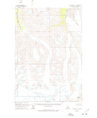
Glacial ice and high mountain drainage define this 1960 field-annotated survey of the Matanuska-Susitna Borough. The landscape is dominated by the massive Nelchina Glacier in the northeast, where the map specifically details numerous crevasses across the ice field. This glaciated terrain feeds the headwaters of the Nelchina River, which flows north along the edge of the ice. To the west, the South Fork Matanuska River carves through deep valleys, joined by smaller tributaries like Middle Creek near Little Lake. These 1:63,360 scale charts provide a primary record of the Chugach Mountains' ice movements and topographical state in the mid-20th century, before modern changes to the Alaskan ice pack. The absence of roads or settlements highlights the isolation of this high-altitude region during the early years of Alaskan statehood.
Find a feature on this map
7 named features on this map. Tap any name to fly to it.
Don’t see what you’re looking for? This feature index may not catch every label — zoom into the map to look around manually.
Map Details
Editions of this 1960 Anchorage C-1 Map
3 editions found
Other maps of this area

1948 · Anchorage D-2
USGS Topo · 1:63,360

1948 · Anchorage D-1
USGS Topo · 1:63,360

1949 · Valdez D-8
USGS Topo · 1:63,360

1951 · Anchorage
USGS Topo · 1:250,000

1951 · Anchorage D-1
USGS Topo · 1:63,360

1952 · Valdez D-8
USGS Topo · 1:63,360

1952 · Anchorage D-2
USGS Topo · 1:63,360

1952 · Valdez
USGS Topo · 1:250,000

1960 · Anchorage C-2
USGS Topo · 1:63,360

1960 · Anchorage B-1
USGS Topo · 1:63,360