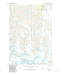
1960 Map of Anchorage C-1
USGS Topo · Published 1987About this map
The glacial reaches of the Chugach National Forest dominate this mid-century survey of the Chugach Mountains. A massive network of ice fields, including the Nelchina Glacier, Sylvester Glacier, and Powell Glacier, carve through the high-elevation terrain near the intersection of the Seward and Copper River Meridians. These frozen giants feed major drainage systems such as the South Fork Matanuska River and the Nelchina River.
Find a feature on this map
13 named features on this map. Tap any name to fly to it.
Don’t see what you’re looking for? This feature index may not catch every label — zoom into the map to look around manually.
Map Details
Editions of this 1960 Anchorage C-1 Map
3 editions found

Other maps of this area

1948 · Anchorage D-2
USGS Topo · 1:63,360

1948 · Anchorage D-1
USGS Topo · 1:63,360

1949 · Valdez D-8
USGS Topo · 1:63,360

1951 · Anchorage
USGS Topo · 1:250,000

1951 · Anchorage D-1
USGS Topo · 1:63,360

1952 · Valdez D-8
USGS Topo · 1:63,360

1952 · Anchorage D-2
USGS Topo · 1:63,360

1952 · Valdez
USGS Topo · 1:250,000

1960 · Anchorage C-2
USGS Topo · 1:63,360

1960 · Anchorage B-1
USGS Topo · 1:63,360