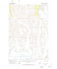
1960 Map of Anchorage C-1
USGS Topo · Published 1977About this map
Nelchina Glacier dominates the eastern expanse of this survey, its massive ice flow marked by extensive crevasses as it descends through the Chugach Mountains. The drainage patterns of the era are clearly defined, showing the South Fork Matanuska River carving through the western terrain while the Nelchina River flows north from the glacier's edge. High-elevation landmarks such as Mount Siegfried stand as prominent anchors in a landscape primarily defined by ice and water. Unlike many USGS quadrangles of this period, the map indicates no roads or trails, documenting a wilderness state where travel was dictated by the natural corridors of Middle Creek and the surrounding glacial valleys. This 1960 field-annotated record provides a specific look at glacial margins and fluvial features before modern climatic shifts altered these high-latitude ice fields.
Find a feature on this map
13 named features on this map. Tap any name to fly to it.
Don’t see what you’re looking for? This feature index may not catch every label — zoom into the map to look around manually.
Map Details
Editions of this 1960 Anchorage C-1 Map
3 editions found

Other maps of this area

1948 · Anchorage D-2
USGS Topo · 1:63,360

1948 · Anchorage D-1
USGS Topo · 1:63,360

1949 · Valdez D-8
USGS Topo · 1:63,360

1951 · Anchorage
USGS Topo · 1:250,000

1951 · Anchorage D-1
USGS Topo · 1:63,360

1952 · Valdez D-8
USGS Topo · 1:63,360

1952 · Anchorage D-2
USGS Topo · 1:63,360

1952 · Valdez
USGS Topo · 1:250,000

1960 · Anchorage C-2
USGS Topo · 1:63,360

1960 · Anchorage B-1
USGS Topo · 1:63,360