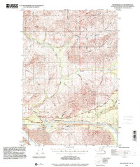
1993 Map of Anchorage D-2
USGS Topo · Published 2001About this map
Matanuska River flows through the southern heart of this quadrangle, flanked by the high elevations of Sheep Mountain and Gunsight Mountain. The landscape is dominated by the massive Matanuska Glacier and numerous glacial tributaries like Glacier Creek and Gravel Creek. Travel through this demanding Alaskan interior was anchored by the Glenn Highway, which served as a lifeline for regional movement between established outposts. Historically significant transit points such as the Meekins Roadhouse and the Sheep Mountain Lodge appear along the road, while a Landing Strip near the lodge provides a look at the bush aviation network required for backcountry access. A prominent Tractor Trail follows the course of Caribou Creek, illustrating the heavy equipment tracks left by resource exploration or early transport before more permanent infrastructure reached into the northern ridges of Horn Mountain and Syncline Mountain.
Find a feature on this map
42 named features on this map. Tap any name to fly to it.
Don’t see what you’re looking for? This feature index may not catch every label — zoom into the map to look around manually.
Map Details
Editions of this 1993 Anchorage D-2 Map
This is the sole edition of this map. No revisions or reprints were ever made.
Other maps of this area

1948 · Anchorage D-3
USGS Topo · 1:63,360

1948 · Anchorage D-2
USGS Topo · 1:63,360

1948 · Anchorage D-1
USGS Topo · 1:63,360

1949 · Talkeetna Mountains A-1
USGS Topo · 1:63,360

1950 · Talkeetna Mountains
USGS Topo · 1:250,000

1951 · Anchorage
USGS Topo · 1:250,000

1951 · Anchorage D-1
USGS Topo · 1:63,360

1951 · Talkeetna Mountains A-2
USGS Topo · 1:63,360

1952 · Anchorage D-2
USGS Topo · 1:63,360

1952 · Anchorage D-3
USGS Topo · 1:63,360