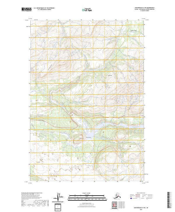
2023 Map of Anchorage D-2 SW
USGS Topo · Published 2023About this map
Lion Head and Glacier Point stand as prominent landmarks overlooking the wide, braided path of the Matanuska River in this section of the Matanuska-Susitna Borough. The landscape is defined by its dramatic relief, moving from the river valley up toward Sheep Mtn and the soaring elevations of Fortress Ridge. This 2023 survey documents the area's modern infrastructure, where the Glenn Highway serves as the primary artery connecting the region.
Find a feature on this map
24 named features on this map. Tap any name to fly to it.
Don’t see what you’re looking for? This feature index may not catch every label — zoom into the map to look around manually.
Map Details
Editions of this 2023 Anchorage D-2 SW Map
This is the sole edition of this map. No revisions or reprints were ever made.
Other maps of this area

1948 · Anchorage D-3
USGS Topo · 1:63,360

1948 · Anchorage D-2
USGS Topo · 1:63,360

1951 · Anchorage
USGS Topo · 1:250,000

1952 · Anchorage D-2
USGS Topo · 1:63,360

1952 · Anchorage D-3
USGS Topo · 1:63,360

1960 · Anchorage C-2
USGS Topo · 1:63,360

1960 · Anchorage C-3
USGS Topo · 1:63,360

1962 · Anchorage
USGS Topo · 1:250,000
1976 · Anchorage D-2
USGS Topo · 1:63,360

1979 · Anchorage
USGS Topo · 1:250,000