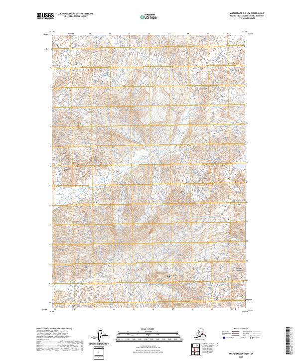
2023 Map of Anchorage D-3 NW
USGS Topo · Published 2023About this map
Glacier View sits at the base of the high-altitude terrain in this section of the Talkeetna Mountains. The landscape is dominated by steep elevation changes and the dendritic drainage patterns of Boulder Creek and East Boulder Creek, which carve through the townships of T22N R7E and T21N R8E. This 2023 survey illustrates the remote character of the Matanuska-Susitna region, where modern mapping captures a high-resolution view of the topographical contours that define the local hydrology. The arrangement of these watercourses through the mountain passes highlights the natural corridors that have historically influenced movement and small-scale settlement in this part of Alaska.
Find a feature on this map
8 named features on this map. Tap any name to fly to it.
Don’t see what you’re looking for? This feature index may not catch every label — zoom into the map to look around manually.
Map Details
Editions of this 2023 Anchorage D-3 NW Map
This is the sole edition of this map. No revisions or reprints were ever made.
Other maps of this area

1948 · Anchorage D-3
USGS Topo · 1:63,360

1948 · Anchorage D-4
USGS Topo · 1:63,360

1950 · Talkeetna Mountains
USGS Topo · 1:250,000

1951 · Anchorage
USGS Topo · 1:250,000

1951 · Talkeetna Mountains A-2
USGS Topo · 1:63,360

1951 · Talkeetna Mountains A-3
USGS Topo · 1:63,360

1952 · Anchorage D-4
USGS Topo · 1:63,360

1952 · Anchorage D-3
USGS Topo · 1:63,360
1952 · Talkeetna Mountains A-2
USGS Topo · 1:63,360
1952 · Talkeetna Mountains A-3
USGS Topo · 1:63,360