
1952 Map of Talkeetna Mountains A-2
USGS Topo · Published 1953About this map
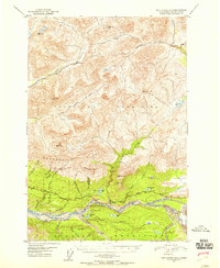
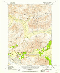
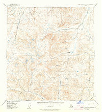
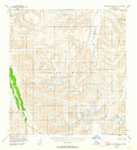
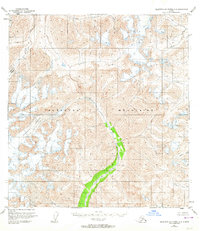
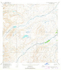
The Talkeetna Mountains dominate this 1952 topographic study, revealing a landscape defined by complex drainages and significant elevation changes in south-central Alaska. The Oshetna River and Little Oshetna River carve through the northern terrain, while the Little Nelchina River flows eastward across the central region. In the south, the Horn Mountains rise above a series of named waterways including Caribou Creek, Mazuma Creek, and Billy Creek.
Find a feature on this map
14 named features on this map. Tap any name to fly to it.
Don’t see what you’re looking for? This feature index may not catch every label — zoom into the map to look around manually.
Map Details
Editions of this 1952 Talkeetna Mountains A-2 Map
This is the sole edition of this map. No revisions or reprints were ever made.
Other maps of this area
1948 · Anchorage D-3
USGS Topo · 1:63,360
1948 · Anchorage D-2
USGS Topo · 1:63,360
1949 · Talkeetna Mountains A-1
USGS Topo · 1:63,360

1950 · Talkeetna Mountains
USGS Topo · 1:250,000

1951 · Anchorage
USGS Topo · 1:250,000
1951 · Talkeetna Mountains B-1
USGS Topo · 1:63,360
1951 · Talkeetna Mountains A-2
USGS Topo · 1:63,360
1951 · Talkeetna Mountains B-3
USGS Topo · 1:63,360
1951 · Talkeetna Mountains A-3
USGS Topo · 1:63,360
1951 · Talkeetna Mountains B-2
USGS Topo · 1:63,360