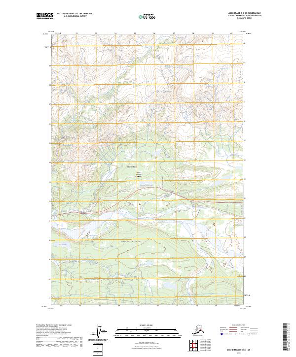
2023 Map of Anchorage D-3 SE
USGS Topo · Published 2023About this map
Matanuska Valley terrain dominates this 2023 survey, centered on the corridor where the Glenn Highway follows the north bank of the Matanuska River. The small settlement of Glacier View serves as a local landmark in this river-bottom landscape, accompanied by the named site of Farrars Landing. The map details a network of local access roads and circles branching off the highway, such as Pinochle Creek Road and Glacier Park Road, which provide entry into the higher elevations. Numerous water bodies like Hundred Mile Lake and Bench Lake are scattered through the lowlands, while significant drainages including Hicks Creek and Pinochle Creek cut through the surrounding slopes. The geography here illustrates the transition between the valley floor and the rising peaks of the Chugach and Talkeetna ranges.
Find a feature on this map
26 named features on this map. Tap any name to fly to it.
Don’t see what you’re looking for? This feature index may not catch every label — zoom into the map to look around manually.
Map Details
Editions of this 2023 Anchorage D-3 SE Map
This is the sole edition of this map. No revisions or reprints were ever made.
Other maps of this area

1948 · Anchorage D-3
USGS Topo · 1:63,360

1948 · Anchorage D-2
USGS Topo · 1:63,360

1951 · Anchorage
USGS Topo · 1:250,000

1952 · Anchorage D-2
USGS Topo · 1:63,360

1952 · Anchorage D-3
USGS Topo · 1:63,360

1960 · Anchorage C-2
USGS Topo · 1:63,360

1960 · Anchorage C-3
USGS Topo · 1:63,360

1962 · Anchorage
USGS Topo · 1:250,000
1976 · Anchorage D-2
USGS Topo · 1:63,360

1979 · Anchorage
USGS Topo · 1:250,000