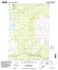
1994 Map of Anchorage D-8
USGS Topo · Published 2002About this map
The Kashwitna River and its intricate network of tributaries define this landscape within the Alaska-Matanuska-Susitna Borough. While topography was compiled in 1949, the planimetry reflects the area as it appeared in the mid-1990s, centered on the drainage systems of Little Willow Creek and Willow Creek. Human activity is concentrated along the southern corridor where Willow Road traverses the terrain, supported by local infrastructure like the Landing Strip and various Gravel Pits.
Find a feature on this map
22 named features on this map. Tap any name to fly to it.
Don’t see what you’re looking for? This feature index may not catch every label — zoom into the map to look around manually.
Map Details
Editions of this 1994 Anchorage D-8 Map
This is the sole edition of this map. No revisions or reprints were ever made.
Other maps of this area

1949 · Tyonek
USGS Topo · 1:250,000

1949 · Anchorage D-7
USGS Topo · 1:63,360

1949 · Anchorage D-8
USGS Topo · 1:63,360

1950 · Talkeetna Mountains
USGS Topo · 1:250,000

1950 · Talkeetna
USGS Topo · 1:250,000

1950 · Anchorage C-8
USGS Topo · 1:63,360

1950 · Anchorage C-7
USGS Topo · 1:63,360

1950 · Talkeetna Mountains A-6
USGS Topo · 1:63,360

1951 · Talkeetna
USGS Topo · 1:250,000

1951 · Anchorage
USGS Topo · 1:250,000