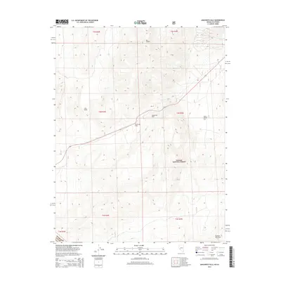
2014 Map of Anchorite Hills
USGS Topo · Published 2014About this map
Anchorite Hills dominate this high-altitude landscape along the border of Mono County and Mineral County, Nevada. The map captures a rugged crossroads of the Great Basin, where Anchorite Pass provides a vital transit point for the route labeled 359. Within the protected expanse of the Toiyabe National Forest, the terrain shifts from the depression of Long Valley in the west to the higher elevations of the Excelsior Mountains in the southeast. Significant geographic basins like Box Canyon and the evocatively named Little Whisky Flat illustrate the varied topography of this eastern Sierra frontier. The layout of the roads and boundaries suggests a territory defined more by its natural landmarks and federal land management than by dense human settlement.
Find a feature on this map
9 named features on this map. Tap any name to fly to it.
Don’t see what you’re looking for? This feature index may not catch every label — zoom into the map to look around manually.
Map Details
Editions of this 2014 Anchorite Hills Map
This is the sole edition of this map. No revisions or reprints were ever made.
Other maps of this area

1909 · Hawthorne
USGS Topo · 1:250,000

1911 · Hawthorne
USGS Topo · 1:250,000

1915 · Hawthorne
USGS Topo · 1:250,000

1948 · Walker Lake
USGS Topo · 1:250,000

1955 · Powell Mtn
USGS Topo · 1:62,500

1956 · Aurora
USGS Topo · 1:62,500

1957 · Walker Lake
USGS Topo · 1:250,000

1958 · Trench Canyon
USGS Topo · 1:62,500

1958 · Huntoon Valley
USGS Topo · 1:62,500

1962 · Walker Lake
USGS Topo · 1:250,000