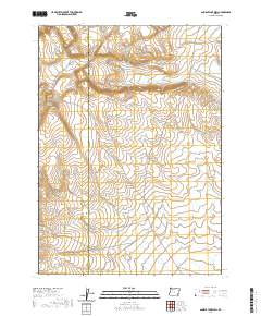
2020 Map of Ancient Lake Well
USGS Topo · Published 2020About this map
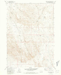
Harney and Malheur County boundaries divide this high-desert landscape in southeastern Oregon, where the terrain is marked by the prominence of Grassy Ridge. This 2020 survey reveals a sparsely developed environment defined by significant elevation changes and the presence of the Ancient Lake Well. The map illustrates the specialized water infrastructure required in this arid region, providing a specific geographic point for researchers studying land use and livestock management in the Oregon high desert. The Public Land Survey System (PLSS) grid is clearly delineated, showing the townships and ranges including t32s r36e and t33s r37e, which are essential for property and boundary research in this remote corner of the state.
Find a feature on this map
7 named features on this map. Tap any name to fly to it.
Don’t see what you’re looking for? This feature index may not catch every label — zoom into the map to look around manually.
Map Details
Editions of this 2020 Ancient Lake Well Map
This is the sole edition of this map. No revisions or reprints were ever made.
Other maps of this area

1955 · Adel
USGS Topo · 1:250,000

1957 · Adel
USGS Topo · 1:250,000

1958 · Adel
USGS Topo · 1:250,000

1962 · Adel
USGS Topo · 1:250,000

1981 · Coyote Lake West
USGS Topo · 1:24,000
1981 · Grassy Ridge Well
USGS Topo · 1:24,000
1981 · Coyote Lake East
USGS Topo · 1:24,000
1981 · Johnny Creek SW
USGS Topo · 1:24,000
1981 · Groan Canyon
USGS Topo · 1:24,000

1981 · Ancient Lake Well
USGS Topo · 1:24,000