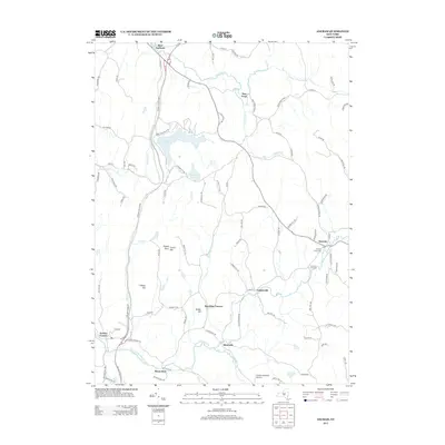
2013 Map of Ancram
USGS Topo · Published 2013About this map
Roeliff Jansen Kill winds through the heart of this Columbia County landscape, serving as a primary drainage for the surrounding hills and valleys. The settlement pattern reflects a deeply rooted agricultural and small-scale industrial past, anchored by communities like Ancram and Gallatinville. To the north, Lake Taghkanic and its namesake State Park dominate the terrain, while the Taconic State Pkwy provides a modern transit artery through the western reaches. Genealogists will find significant value in the documentation of the Ancram Union Cem and Ancram Old Cem. Smaller hamlets such as Silvernails and the historically suggestive Spaulding Furnace indicate past economic activity along the waterways, where names like Snydam Cr and Fall Kill intersect with local roads. The map also captures the local aviation history at Silvernails Field Airport and southern heights near Mount Ross.
Find a feature on this map
90 named features on this map. Tap any name to fly to it.
Don’t see what you’re looking for? This feature index may not catch every label — zoom into the map to look around manually.
Map Details
Editions of this 2013 Ancram Map
This is the sole edition of this map. No revisions or reprints were ever made.
Other maps of this area

1895 · Catskill
USGS Topo · 1:62,500

1898 · Rhinebeck
USGS Topo · 1:62,500

1899 · Millbrook
USGS Topo · 1:62,500

1902 · Millbrook
USGS Topo · 1:62,500

1902 · Copake
USGS Topo · 1:62,500

1904 · Copake
USGS Topo · 1:62,500

1934 · Rhinebeck
USGS Topo · 1:48,000

1934 · Catskill
USGS Topo · 1:62,500

1938 · Catskill
USGS Topo · 1:62,500

1939 · Rhinebeck
USGS Topo · 1:62,500