
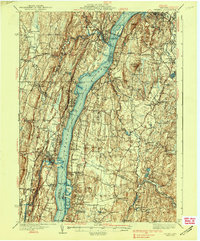
1938 Map of Catskill
USGS Topo · Published 1938About this map
The Hudson River serves as the central artery for this 1930s survey, dividing Greene, Columbia, Ulster, and Dutchess counties. The landscape is defined by its deep historical roots and river-based commerce, evidenced by the Birthplace of Robert Livingston near Germantown and numerous riverfront settlements like Malden on Hudson and Smith Landing. The industrial and social infrastructure of the era is well-documented, from the New York Central railroad tracks hugging the eastern shore to the rural school system represented by Schuylerhook Sch and Stone Mill Sch.
Find a feature on this map
123 named features on this map. Tap any name to fly to it.
Don’t see what you’re looking for? This feature index may not catch every label — zoom into the map to look around manually.
Map Details
Editions of this 1938 Catskill Map
2 editions found
Other maps of this area

1892 · Kaaterskill
USGS Topo · 1:62,500

1893 · Kaaterskill
USGS Topo · 1:62,500

1893 · Coxsackie
USGS Topo · 1:62,500

1893 · Durham
USGS Topo · 1:62,500

1894 · Coxsackie
USGS Topo · 1:62,500

1894 · Kaaterskill
USGS Topo · 1:62,500

1894 · Durham
USGS Topo · 1:62,500

1895 · Catskill
USGS Topo · 1:62,500

1898 · Rhinebeck
USGS Topo · 1:62,500

1899 · Kaaterskill
USGS Topo · 1:62,500