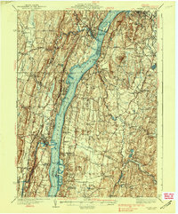
1938 Map of Catskill
USGS Topo · Published 1938About this map
The Hudson River serves as the central artery for this 1930s survey, connecting the riverfront economies of Catskill, Saugerties, and Germantown. This era marks a transition in regional infrastructure, notably anchored by the Rip Van Winkle Bridge spanning the water to connect Greene and Columbia counties. Along the banks, industrial sites like Washburn Dock and the New York Central railroad tracks demonstrate the heavy reliance on the river corridor for transport and commerce.
Find a feature on this map
108 named features on this map. Tap any name to fly to it.
Don’t see what you’re looking for? This feature index may not catch every label — zoom into the map to look around manually.
Map Details
Editions of this 1938 Catskill Map
2 editions found

Other maps of this area

1892 · Kaaterskill
USGS Topo · 1:62,500

1893 · Kaaterskill
USGS Topo · 1:62,500

1893 · Coxsackie
USGS Topo · 1:62,500

1893 · Durham
USGS Topo · 1:62,500

1894 · Coxsackie
USGS Topo · 1:62,500

1894 · Kaaterskill
USGS Topo · 1:62,500

1894 · Durham
USGS Topo · 1:62,500

1895 · Catskill
USGS Topo · 1:62,500

1898 · Rhinebeck
USGS Topo · 1:62,500

1899 · Kaaterskill
USGS Topo · 1:62,500