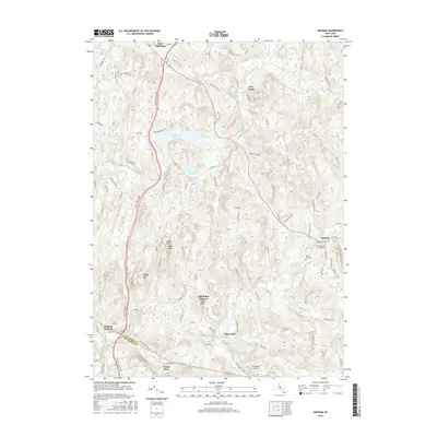
2016 Map of Ancram
USGS Topo · Published 2016About this map
Ancram and its surrounding hamlets sit within a landscape defined by the winding course of the Roeliff Jansen Kill and its various tributaries. This modern survey illustrates the enduring rural character of Columbia and Dutchess Counties, where legacy sites like the Ancram Old Cem and Ancram Union Cem remain central to the local geography. The terrain is marked by prominent elevations such as Tiffany Hill and the uniquely named Spaulding Furnace Snake Hill, suggesting a history of early industry tucked into the valleys. Further west, Lake Taghkanic and Pond Lily Pond dominate the northern drainage, while the Taconic State Pkwy provides the primary north-south artery through the hills, bypassing older settlements like Silvernails and West Taghkanic.
Find a feature on this map
85 named features on this map. Tap any name to fly to it.
Don’t see what you’re looking for? This feature index may not catch every label — zoom into the map to look around manually.
Map Details
Editions of this 2016 Ancram Map
This is the sole edition of this map. No revisions or reprints were ever made.
Other maps of this area

1895 · Catskill
USGS Topo · 1:62,500

1898 · Rhinebeck
USGS Topo · 1:62,500

1899 · Millbrook
USGS Topo · 1:62,500

1902 · Millbrook
USGS Topo · 1:62,500

1902 · Copake
USGS Topo · 1:62,500

1904 · Copake
USGS Topo · 1:62,500

1934 · Rhinebeck
USGS Topo · 1:48,000

1934 · Catskill
USGS Topo · 1:62,500

1938 · Catskill
USGS Topo · 1:62,500

1939 · Rhinebeck
USGS Topo · 1:62,500