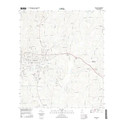
2014 Map of Andalusia
USGS Topo · Published 2014About this map
Andalusia serves as the focal point of this Covington County landscape, where the street grid of the city meets a network of creeks and memorial grounds. The city's eastern expansion is marked by several established cemeteries, including Magnolia Cem and Marshall Memorial Cem. To the southeast, the town of Sanford is situated near the South Alabama Regional Airport at Bill Benton Field, a primary regional transit hub. The surrounding terrain is defined by a dense drainage network, with Five Runs Cr and Lindsey Mill Br carving through the countryside. Smaller communities like Heath to the north and Libertyville to the south anchor the outlying areas, while Pineview Lake provides a notable water feature amidst the residential and agricultural land south of the city center.
Find a feature on this map
143 named features on this map. Tap any name to fly to it.
Don’t see what you’re looking for? This feature index may not catch every label — zoom into the map to look around manually.
Map Details
Editions of this 2014 Andalusia Map
This is the sole edition of this map. No revisions or reprints were ever made.
Other maps of this area

1953 · Andalusia
USGS Topo · 1:250,000

1957 · Andalusia
USGS Topo · 1:250,000

1971 · Carolina
USGS Topo · 1:24,000

1971 · Libertyville
USGS Topo · 1:24,000

1971 · Dozier
USGS Topo · 1:24,000

1971 · Onycha
USGS Topo · 1:24,000

1971 · River Falls
USGS Topo · 1:24,000

1971 · Andalusia
USGS Topo · 1:24,000

1971 · Gantt
USGS Topo · 1:24,000

1971 · Red Level
USGS Topo · 1:24,000