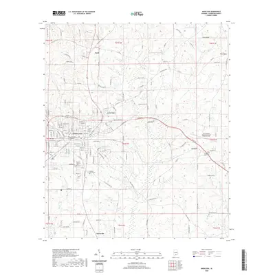
2020 Map of Andalusia
USGS Topo · Published 2020About this map
Andalusia serves as the central hub of this Covington County landscape, where the Covington County Courthouse and numerous historic burial grounds like Magnolia Cem and Southside Cem anchor the community's history. The map illustrates a transition from the structured residential blocks of the city to the more rural surrounding settlements of Heath, Sanford, and Libertyville. Education and modern infrastructure are represented by the sprawling campus of Lurleen Wallace Community College and the South Alabama Regional Airport at Bill Benton Field to the east.
Find a feature on this map
166 named features on this map. Tap any name to fly to it.
Don’t see what you’re looking for? This feature index may not catch every label — zoom into the map to look around manually.
Map Details
Editions of this 2020 Andalusia Map
This is the sole edition of this map. No revisions or reprints were ever made.
Other maps of this area

1953 · Andalusia
USGS Topo · 1:250,000

1957 · Andalusia
USGS Topo · 1:250,000

1971 · Carolina
USGS Topo · 1:24,000

1971 · Libertyville
USGS Topo · 1:24,000

1971 · Dozier
USGS Topo · 1:24,000

1971 · Onycha
USGS Topo · 1:24,000

1971 · River Falls
USGS Topo · 1:24,000

1971 · Andalusia
USGS Topo · 1:24,000

1971 · Gantt
USGS Topo · 1:24,000

1971 · Red Level
USGS Topo · 1:24,000