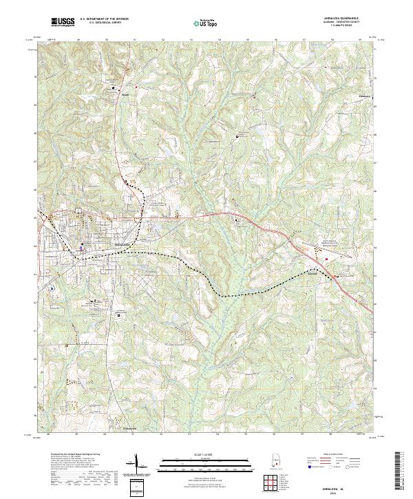
2024 Map of Andalusia
USGS Topo · Published 2024About this map
Andalusia serves as the focal point of this Covington County survey, showing the city's modern layout around the Covington County Courthouse. The map documents a significant concentration of local heritage sites, including the Magnolia Cem and Andalusia Memorial Cem. Beyond the city limits, the landscape transitions into the rural communities of Heath, Sanford, and Libertyville, where a network of country churches and family-oriented cemeteries like Bethany Baptist Church Cem dot the countryside. Educational and infrastructure developments are prominent, specifically the campus of Lurleen Wallace Community College and the South Alabama Regional Airport at Bill Benton Field. Waterways such as Five Runs Creek and Mill Creek cut through the terrain, while smaller features like Pineview Lake and Lake Courtney provide local points of interest.
Find a feature on this map
123 named features on this map. Tap any name to fly to it.
Don’t see what you’re looking for? This feature index may not catch every label — zoom into the map to look around manually.
Map Details
Editions of this 2024 Andalusia Map
This is the sole edition of this map. No revisions or reprints were ever made.
Other maps of this area

1953 · Andalusia
USGS Topo · 1:250,000

1957 · Andalusia
USGS Topo · 1:250,000

1971 · Carolina
USGS Topo · 1:24,000

1971 · Libertyville
USGS Topo · 1:24,000

1971 · Dozier
USGS Topo · 1:24,000

1971 · Onycha
USGS Topo · 1:24,000

1971 · River Falls
USGS Topo · 1:24,000

1971 · Andalusia
USGS Topo · 1:24,000

1971 · Gantt
USGS Topo · 1:24,000

1971 · Red Level
USGS Topo · 1:24,000