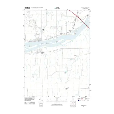
2010 Map of Andalusia
USGS Topo · Published 2010About this map
The Mississippi River separates the riverside communities of Buffalo and Andalusia in this study of the borderlands between Scott County, Iowa, and Rock Island County, Illinois. The river's complexity is revealed through a series of numbered islands, including Island Number 322, and the prominent Horse Island near Walnut Grove. On the Illinois side, the landscape rises toward the Army Ridge Bluffs, drained by Turkey Hollow Creek and its associated Turkey Hollow Reservoir. Genealogists will find a significant concentration of burial sites, from Rose Hill Cemetery and Saint Peter's Cemetery in Iowa to the Andalusia Cemetery and Asbury Cemetery. The mapping of small settlements like Taylor Ridge and Jamestown alongside industrial and transport markers like Railroad St illustrates the enduring connection between the river valley's topography and its residential growth.
Find a feature on this map
78 named features on this map. Tap any name to fly to it.
Don’t see what you’re looking for? This feature index may not catch every label — zoom into the map to look around manually.
Map Details
Editions of this 2010 Andalusia Map
This is the sole edition of this map. No revisions or reprints were ever made.
Other maps of this area

1890 · Durant
USGS Topo · 1:62,500

1891 · Davenport
USGS Topo · 1:62,500

1894 · Durant
USGS Topo · 1:62,500

1894 · Davenport
USGS Topo · 1:62,500

1901 · Rock Island
USGS Topo · 1:125,000

1910 · Rock Island
USGS Topo · 1:125,000

1912 · Milan
USGS Topo · 1:62,500

1916 · Edgington
USGS Topo · 1:62,500

1938 · Edgington
USGS Topo · 1:62,500

1944 · Milan
USGS Topo · 1:62,500