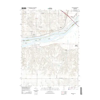
2015 Map of Andalusia
USGS Topo · Published 2015About this map
The Mississippi River creates a natural corridor through the heart of this landscape, separating the river towns of Buffalo and Linwood on the Iowa side from Andalusia in Illinois. These mid-river islands, including Andalusia Island and several numbered landmasses such as Island Number 317, define the complex waterway of the Andalusia Slough and Swift Slough. To the south, the terrain rises sharply into the Army Ridge Bluffs, where the landscape transitions into the deep drainages of Turkey Hollow Cr and Fancy Cr. This era shows significant suburban development in areas like Buffalo Heights and Walnut Grove, while preserving numerous local history landmarks such as Saint Peter's Cem and Asbury Cem. The southern Illinois uplands around Taylor Ridge remain characterized by agricultural patterns and the Turkey Hollow Reservoir.
Find a feature on this map
100 named features on this map. Tap any name to fly to it.
Don’t see what you’re looking for? This feature index may not catch every label — zoom into the map to look around manually.
Map Details
Editions of this 2015 Andalusia Map
This is the sole edition of this map. No revisions or reprints were ever made.
Other maps of this area

1890 · Durant
USGS Topo · 1:62,500

1891 · Davenport
USGS Topo · 1:62,500

1894 · Durant
USGS Topo · 1:62,500

1894 · Davenport
USGS Topo · 1:62,500

1901 · Rock Island
USGS Topo · 1:125,000

1910 · Rock Island
USGS Topo · 1:125,000

1912 · Milan
USGS Topo · 1:62,500

1916 · Edgington
USGS Topo · 1:62,500

1938 · Edgington
USGS Topo · 1:62,500

1944 · Milan
USGS Topo · 1:62,500