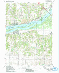
1991 Map of Andalusia
USGS Topo · Published 1992About this map
The Mississippi River creates a natural divide between Iowa and Illinois in this early 1990s record of the Quad Cities region. On the Iowa side, the riverside industrial character is defined by a large Quarry and the town of Buffalo, while the hills to the north are home to the communities of Buffalo Heights and Jamestown. Across the water, the town of Andalusia sits behind Andalusia Island, separated by a broad Slough. This survey provides valuable documentation for genealogists, showing the exact locations of Asbury Cem, St Peters Cem, and Rose Hill Cem. Transportation history is evident in the Old RR GB and an Old Grade near Rock Island, illustrating the shifting infrastructure of the river valley. The map also includes several river features such as Horse Island and the sprawling Credit Island Park near Nahant.
Find a feature on this map
39 named features on this map. Tap any name to fly to it.
Don’t see what you’re looking for? This feature index may not catch every label — zoom into the map to look around manually.
Map Details
Editions of this 1991 Andalusia Map
This is the sole edition of this map. No revisions or reprints were ever made.
Other maps of this area

1890 · Durant
USGS Topo · 1:62,500

1891 · Davenport
USGS Topo · 1:62,500

1894 · Durant
USGS Topo · 1:62,500

1894 · Davenport
USGS Topo · 1:62,500

1901 · Rock Island
USGS Topo · 1:125,000

1910 · Rock Island
USGS Topo · 1:125,000

1912 · Milan
USGS Topo · 1:62,500

1916 · Edgington
USGS Topo · 1:62,500

1938 · Edgington
USGS Topo · 1:62,500

1944 · Milan
USGS Topo · 1:62,500