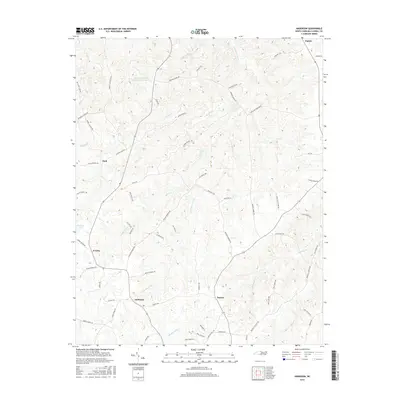
2016 Map of Anderson
USGS Topo · Published 2016About this map
Anderson and Baynes anchor the southern portion of this landscape where the headwaters of S Country Line Cr and Hughes Mill Cr begin their descent through the Piedmont. The area is defined by a dense network of family-named roads, including Mary Jane Bigelow Rd, Badgett Sisters Pkwy, and George Russell Rd, reflecting generations of land ownership in this part of Caswell County. In the north, the Caswell Wildlife Mgmt Area Pond O represents a significant protected area amidst the undulating terrain. To the west, the settlement of Fitch and the waters of Williams Lake mark the transitions between small rural centers. The topography is shaped by numerous small watercourses such as Burkes Cr and Penson Cr, which have historically dictated the placement of homesteads and the winding paths of the local road system.
Find a feature on this map
68 named features on this map. Tap any name to fly to it.
Don’t see what you’re looking for? This feature index may not catch every label — zoom into the map to look around manually.
Map Details
Editions of this 2016 Anderson Map
This is the sole edition of this map. No revisions or reprints were ever made.
Other maps of this area

1953 · Greensboro
USGS Topo · 1:250,000

1954 · Greensboro
USGS Topo · 1:250,000

1962 · Greensboro
USGS Topo · 1:250,000

1966 · Greensboro
USGS Topo · 1:250,000

1967 · Cedar Grove
USGS Topo · 1:24,000

1968 · Leasburg
USGS Topo · 1:24,000

1968 · Ridgeville
USGS Topo · 1:24,000

1969 · Lake Burlington
USGS Topo · 1:24,000

1969 · Burlington NE
USGS Topo · 1:24,000
1972 · Anderson
USGS Topo · 1:24,000