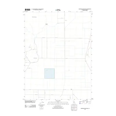
2012 Map of Anderson Mountain
USGS Topo · Published 2012About this map
Anderson Mountain dominates the northern skyline of this Lassen County landscape, where the terrain transitions into the drainages of Anderson Canyon. The map reveals a grid of rural infrastructure characterized by a systematic naming convention for its local thoroughfares. Roads like Parakeet, Nightowl, Mallard Dr, Pintail, and Raven Rd suggest a deliberate organization of this high-desert environment. Local industry and land use are anchored by Monroe Corrals in the southeast, while prominent geographic markers like Ninemile Point provide orientation across the expansive flats. Long-established routes such as Brockman Rd and Williams Rd serve as the primary conduits through this sparsely settled portion of California, connecting the various ranching and residential tracts that define the region's modern character.
Find a feature on this map
21 named features on this map. Tap any name to fly to it.
Don’t see what you’re looking for? This feature index may not catch every label — zoom into the map to look around manually.
Map Details
Editions of this 2012 Anderson Mountain Map
This is the sole edition of this map. No revisions or reprints were ever made.
Other maps of this area

1886 · Alturas
USGS Topo · 1:250,000

1886 · Honey Lake
USGS Topo · 1:250,000

1891 · Honey Lake
USGS Topo · 1:250,000

1892 · Alturas
USGS Topo · 1:250,000

1893 · Honey Lake
USGS Topo · 1:250,000

1954 · Grasshopper Valley
USGS Topo · 1:62,500

1954 · Ravendale
USGS Topo · 1:62,500

1954 · Alturas
USGS Topo · 1:250,000

1955 · Westwood
USGS Topo · 1:250,000

1958 · Alturas
USGS Topo · 1:250,000