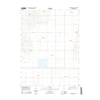
2015 Map of Anderson Mountain
USGS Topo · Published 2015About this map
Anderson Mountain dominates the northern skyline of this high-desert landscape in Lassen County, where the terrain drops sharply toward the expansive Madeline Plains. The settlement of Brockman sits along the eastern edge of the quadrangle, situated near the intersection of several local thoroughfares including Swan Rd and Brockman Rd. A network of rural roads with distinctive avian and wildlife names, such as Nightowl, Mallard Dr, Parakeet, and Coyote, suggests a modern subdivision of the land into large rural parcels or recreational plots. The western slopes are carved by Anderson Canyon, while Ninemile Point stands as a prominent topographical feature overlooking the central flats. This survey by the U.S. Geological Survey documents the intersection of public land survey sections across Townships 35, 36, and 37 North, illustrating the grid-based development typical of this part of northeastern California.
Find a feature on this map
29 named features on this map. Tap any name to fly to it.
Don’t see what you’re looking for? This feature index may not catch every label — zoom into the map to look around manually.
Map Details
Editions of this 2015 Anderson Mountain Map
This is the sole edition of this map. No revisions or reprints were ever made.
Other maps of this area

1886 · Alturas
USGS Topo · 1:250,000

1886 · Honey Lake
USGS Topo · 1:250,000

1891 · Honey Lake
USGS Topo · 1:250,000

1892 · Alturas
USGS Topo · 1:250,000

1893 · Honey Lake
USGS Topo · 1:250,000

1954 · Grasshopper Valley
USGS Topo · 1:62,500

1954 · Ravendale
USGS Topo · 1:62,500

1954 · Alturas
USGS Topo · 1:250,000

1955 · Westwood
USGS Topo · 1:250,000

1958 · Alturas
USGS Topo · 1:250,000