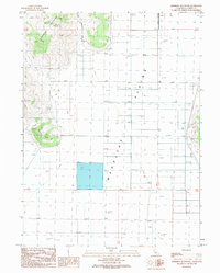
1989 Map of Anderson Mountain
USGS Topo · Published 1989About this map
Anderson Mountain dominates the northwestern corner of this high desert terrain, giving way to the expansive flatlands of the Madeline Plains to the east. This 1989 provisional survey captures a landscape defined by water management and resource extraction in Lassen County. A series of deep wells, such as Well 5288T and Well 5286T, are scattered across the plains, suggesting the critical role of groundwater for this arid region.
Find a feature on this map
17 named features on this map. Tap any name to fly to it.
Don’t see what you’re looking for? This feature index may not catch every label — zoom into the map to look around manually.
Map Details
Editions of this 1989 Anderson Mountain Map
This is the sole edition of this map. No revisions or reprints were ever made.
Other maps of this area

1886 · Alturas
USGS Topo · 1:250,000

1886 · Honey Lake
USGS Topo · 1:250,000

1891 · Honey Lake
USGS Topo · 1:250,000

1892 · Alturas
USGS Topo · 1:250,000

1893 · Honey Lake
USGS Topo · 1:250,000

1954 · Grasshopper Valley
USGS Topo · 1:62,500

1954 · Ravendale
USGS Topo · 1:62,500

1954 · Alturas
USGS Topo · 1:250,000

1955 · Westwood
USGS Topo · 1:250,000

1958 · Alturas
USGS Topo · 1:250,000