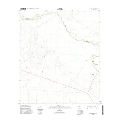
2016 Map of Anderson Ranch
USGS Topo · Published 2016About this map
The Pecos River serves as the winding natural boundary between Loving and Reeves counties in this West Texas survey. The landscape is defined by the drainage patterns of significant arid landforms, including John D Draw, Smith Draw, and the curiously named Horsehead Draw. These features highlight the importance of water management in a region where cattle ranching has long been the primary industry, as evidenced by the Anderson Ranch complex and the presence of Smith Tank.
Find a feature on this map
13 named features on this map. Tap any name to fly to it.
Don’t see what you’re looking for? This feature index may not catch every label — zoom into the map to look around manually.
Map Details
Editions of this 2016 Anderson Ranch Map
This is the sole edition of this map. No revisions or reprints were ever made.
Other maps of this area

1931 · Orla
USGS Topo · 1:62,500

1954 · Pecos
USGS Topo · 1:250,000

1957 · Pecos
USGS Topo · 1:250,000

1961 · Mentone
USGS Topo · 1:24,000

1961 · Anderson Ranch
USGS Topo · 1:24,000

1961 · Orla SE
USGS Topo · 1:24,000

1961 · Lindley Ranch
USGS Topo · 1:24,000

1961 · Sand Lake
USGS Topo · 1:24,000

1961 · Narrow Bow Draw
USGS Topo · 1:24,000
1968 · Halamicek Ranch
USGS Topo · 1:24,000