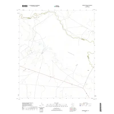
2019 Map of Anderson Ranch
USGS Topo · Published 2019About this map
The Pecos River snakes across the northern and eastern boundary of this West Texas landscape, defining the border between Loving and Reeves counties. This arid Trans-Pecos region is characterized by ephemeral drainage patterns, including the prominent Horsehead Draw, Smith Draw, and John D Draw, which channel seasonal runoff toward the river. Human presence is sparse, centered on the ranching infrastructure of the Anderson Ranch and the small settlement of Arno in the eastern portion of the quadrangle. The map details a network of rural routes such as Co Rd 428 and Co Rd 431, which connect remote homesteads and vital water sources like Smith Tank. The survey reflects a modern era of land management where traditional ranching landmarks persist alongside a high-precision road network in one of the most sparsely populated corners of the state.
Find a feature on this map
11 named features on this map. Tap any name to fly to it.
Don’t see what you’re looking for? This feature index may not catch every label — zoom into the map to look around manually.
Map Details
Editions of this 2019 Anderson Ranch Map
This is the sole edition of this map. No revisions or reprints were ever made.
Other maps of this area

1931 · Orla
USGS Topo · 1:62,500

1954 · Pecos
USGS Topo · 1:250,000

1957 · Pecos
USGS Topo · 1:250,000

1961 · Mentone
USGS Topo · 1:24,000

1961 · Anderson Ranch
USGS Topo · 1:24,000

1961 · Orla SE
USGS Topo · 1:24,000

1961 · Lindley Ranch
USGS Topo · 1:24,000

1961 · Sand Lake
USGS Topo · 1:24,000

1961 · Narrow Bow Draw
USGS Topo · 1:24,000
1968 · Halamicek Ranch
USGS Topo · 1:24,000