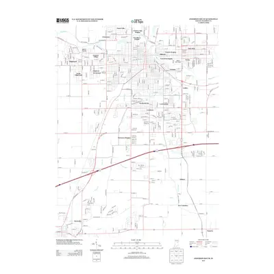
2013 Map of Anderson South
USGS Topo · Published 2013About this map
The White River winds through the northern portion of this landscape, carving a path past residential enclaves like Woodlawn Heights and White River Bluff. To the south, the terrain opens into a matrix of agricultural sections and established communities, including the historic settlement of Huntsville and the village of New Columbus. The drainage patterns here are complex, defined by several significant waterways such as Fall Creek, Sugar Fork, and Prairie Creek, alongside man-made improvements like Stanley Ditch and Michael Ditch. This drainage network supported the early development of outlying neighborhoods like Alliance and Emporia. The infrastructure reveals a mix of old turnpikes and modern thoroughfares, with Huntsville Pike and State Road 236 connecting the various residential heights and industrial pockets like Irondale to the broader Madison County region.
Find a feature on this map
61 named features on this map. Tap any name to fly to it.
Don’t see what you’re looking for? This feature index may not catch every label — zoom into the map to look around manually.
Map Details
Editions of this 2013 Anderson South Map
This is the sole edition of this map. No revisions or reprints were ever made.
Other maps of this area

1952 · Ingalls
USGS Topo · 1:24,000

1952 · Anderson
USGS Topo · 1:24,000

1953 · Pendleton
USGS Topo · 1:24,000

1953 · Lapel
USGS Topo · 1:24,000

1953 · Cincinnati
USGS Topo · 1:250,000

1953 · Muncie
USGS Topo · 1:250,000

1956 · Muncie
USGS Topo · 1:250,000

1957 · Cincinnati
USGS Topo · 1:250,000

1960 · Gilman
USGS Topo · 1:24,000

1960 · Middletown
USGS Topo · 1:24,000