
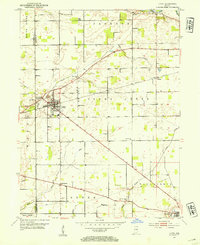
1953 Map of Lapel
USGS Topo · Published 1954About this map
Lapel and Fishersburg sit at the center of this Madison County survey, where the Central Indiana railroad corridor intersects a landscape defined by small-scale farming and local extraction. A prominent Limestone Quarry and the Township Sch highlight the community's mid-century infrastructure. The terrain is marked by the winding courses of Stony Creek and the White River to the north, while the southern reaches extend toward the edge of Pendleton. For genealogists, the map preserves the exact placement of local landmarks like Beall Chapel, Old German Ch, and the Old Woodward Cem. The layout of the road network and the presence of a Pipe Line through Green and Fall Creek townships reflect the region's steady transition from an agrarian base to an industrializing interior during the 1950s.
Find a feature on this map
27 named features on this map. Tap any name to fly to it.
Don’t see what you’re looking for? This feature index may not catch every label — zoom into the map to look around manually.
Map Details
Editions of this 1953 Lapel Map
2 editions found
Other maps of this area

1952 · Ingalls
USGS Topo · 1:24,000

1952 · Mc Cordsville
USGS Topo · 1:24,000

1952 · Anderson
USGS Topo · 1:24,000

1953 · Pendleton
USGS Topo · 1:24,000

1953 · Riverwood
USGS Topo · 1:24,000

1953 · Cincinnati
USGS Topo · 1:250,000

1953 · Muncie
USGS Topo · 1:250,000

1956 · Muncie
USGS Topo · 1:250,000

1957 · Cincinnati
USGS Topo · 1:250,000

1960 · Anderson North
USGS Topo · 1:24,000