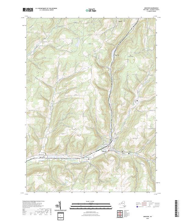
2023 Map of Andover
USGS Topo · Published 2023About this map
Andover serves as the central hub of this Allegany County landscape, situated at the confluence of several vital waterways including Dyke Creek, East Valley Creek, and Railroad Brook. The village layout is densely detailed, showing street-level orientation along E Chestnut St and E Greenwood St. To the west, the smaller settlement of Elm Valley occupies a stretch of the valley floor near the Cole Dyke Cem.
Find a feature on this map
80 named features on this map. Tap any name to fly to it.
Don’t see what you’re looking for? This feature index may not catch every label — zoom into the map to look around manually.
Map Details
Editions of this 2023 Andover Map
This is the sole edition of this map. No revisions or reprints were ever made.
Other maps of this area

1915 · Hornell
USGS Topo · 1:62,500

1916 · Canaseraga
USGS Topo · 1:62,500

1918 · Hornell
USGS Topo · 1:62,500

1926 · Wellsville
USGS Topo · 1:62,500

1926 · Greenwood
USGS Topo · 1:62,500

1940 · Canaseraga
USGS Topo · 1:62,500

1950 · Elmira
USGS Topo · 1:250,000

1958 · Elmira
USGS Topo · 1:250,000

1962 · Elmira
USGS Topo · 1:250,000
1964 · Alfred
USGS Topo · 1:24,000