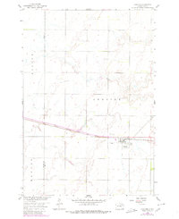
1958 Map of Andover
USGS Topo · Published 1980About this map
Andover serves as the central hub of this Great Plains survey, situated at the crossroads of vital transportation routes across the Brown Co Day Co line. The settlement's layout is defined by its proximity to the Chicago Milwaukee St Paul and Pacific railroad, which tracks across the prairie landscape. The town site includes notable community landmarks such as the Andover Cem and All Saints Cem, reflecting the local genealogy and settlement history of the region. Topographic details reveal the agricultural character of the high plains, punctuated by industrial markers like a Gravel Pit to the north. Surveyed in the late 1950s and updated with late 1970s aerial photography, the map documents the persistent township boundaries of Groton, Hanson, and Andover.
Find a feature on this map
11 named features on this map. Tap any name to fly to it.
Don’t see what you’re looking for? This feature index may not catch every label — zoom into the map to look around manually.
Map Details
Editions of this 1958 Andover Map
2 editions found
Other maps of this area

1895 · Aberdeen
USGS Topo · 1:125,000

1896 · Columbia
USGS Topo · 1:125,000

1952 · Huffton
USGS Topo · 1:24,000

1953 · Milbank
USGS Topo · 1:250,000

1954 · Groton
USGS Topo · 1:24,000

1954 · Ferney
USGS Topo · 1:24,000

1954 · Aberdeen
USGS Topo · 1:250,000

1956 · Aberdeen
USGS Topo · 1:250,000

1958 · Milbank
USGS Topo · 1:250,000

1958 · Andover
USGS Topo · 1:24,000