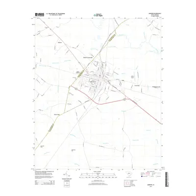
2014 Map of Andrews
USGS Topo · Published 2014About this map
Andrews sits at the intersection of Georgetown and Williamsburg counties, serving as a central hub for the surrounding lowcountry hamlets and vast wetland systems. This 2014 survey reveals the town's grid expanding toward West Andrews and Italy, while the Robert F Swinnie Airport facilitates regional connection to the east. The landscape is defined by the Black River and an intricate network of Carolina bays and swamplands, including Horse Pen Swamp, Murray Swamp, and the expansive Boggy Swamp to the south.
Find a feature on this map
105 named features on this map. Tap any name to fly to it.
Don’t see what you’re looking for? This feature index may not catch every label — zoom into the map to look around manually.
Map Details
Editions of this 2014 Andrews Map
This is the sole edition of this map. No revisions or reprints were ever made.
Other maps of this area

1942 · Cedar Creek
USGS Topo · 1:24,000

1943 · Olin
USGS Topo · 1:31,680

1943 · Trio
USGS Topo · 1:24,000

1943 · Kilsock Bay
USGS Topo · 1:24,000

1943 · Rhems
USGS Topo · 1:24,000

1943 · Andrews
USGS Topo · 1:24,000

1943 · Jamestown
USGS Topo · 1:24,000

1946 · Indiantown
USGS Topo · 1:62,500

1949 · Georgetown
USGS Topo · 1:250,000

1967 · Georgetown
USGS Topo · 1:250,000