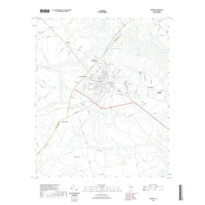
2020 Map of Andrews
USGS Topo · Published 2020About this map
Andrews serves as a focal point where the coastal plain’s agricultural land meets the extensive wetlands of the Lowcountry. Situated along the border of Williamsburg Co and Georgetown Co, the town is surrounded by a complex network of named drainages, including Chicken Swamp, Horse Pen Swamp, and the Black River Swamp. The landscape is defined by its "bays"—distinctive elliptical depressions like Ricefield Bay and Waterhole Bay—and elevated features such as Cross Bay Ridge.
Find a feature on this map
123 named features on this map. Tap any name to fly to it.
Don’t see what you’re looking for? This feature index may not catch every label — zoom into the map to look around manually.
Map Details
Editions of this 2020 Andrews Map
This is the sole edition of this map. No revisions or reprints were ever made.
Other maps of this area

1942 · Cedar Creek
USGS Topo · 1:24,000

1943 · Olin
USGS Topo · 1:31,680

1943 · Trio
USGS Topo · 1:24,000

1943 · Kilsock Bay
USGS Topo · 1:24,000

1943 · Rhems
USGS Topo · 1:24,000

1943 · Andrews
USGS Topo · 1:24,000

1943 · Jamestown
USGS Topo · 1:24,000

1946 · Indiantown
USGS Topo · 1:62,500

1949 · Georgetown
USGS Topo · 1:250,000

1967 · Georgetown
USGS Topo · 1:250,000