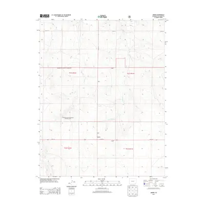
2013 Map of Andrix
USGS Topo · Published 2013About this map
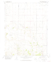
Andrix serves as the primary landmark in this high plains section of Las Animas County, situated along the southern edge of the Comanche National Grassland. The landscape is defined by the ephemeral drainages of Mustang Creek and O U Creek, which carve subtle topography through the range land. Human presence is sparse, centered on the historic Andrix Cemetery and the east-west corridor of US Highway 160. This 2013 survey illustrates the enduring nature of the settlement pattern in this part of Southeast Colorado, where large-scale ranching and land conservation are the primary uses. The grid of county roads, including County Road 52 and County Road 215, provides access to the vast open spaces of the public grasslands, reflecting the area's agricultural and conservation identity in the early 21st century.
Find a feature on this map
12 named features on this map. Tap any name to fly to it.
Don’t see what you’re looking for? This feature index may not catch every label — zoom into the map to look around manually.
Map Details
Editions of this 2013 Andrix Map
This is the sole edition of this map. No revisions or reprints were ever made.
Other maps of this area

1892 · Mt Carrizo
USGS Topo · 1:125,000

1955 · La Junta
USGS Topo · 1:250,000

1958 · La Junta
USGS Topo · 1:250,000

1968 · La Junta
USGS Topo · 1:250,000

1978 · Pintada Creek
USGS Topo · 1:24,000

1978 · Utleyville
USGS Topo · 1:24,000
1978 · Robbers Roost Canyon
USGS Topo · 1:24,000
1978 · Table Mesa
USGS Topo · 1:24,000
1978 · Buck Canyon
USGS Topo · 1:24,000
1978 · Carrizo Mountain
USGS Topo · 1:24,000