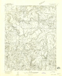
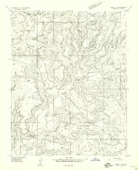
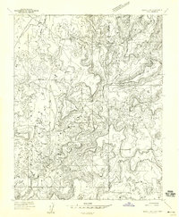
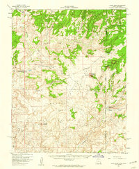
1958 Map of Aneth 1 SW
USGS Topo · Published 1959About this map
Navajo Indian Reservation lands dominate this mid-century survey of the Utah-Arizona borderlands, characterized by the dramatic erosional geography of Cajon Mesa and West Canyon. This 1958 preliminary edition captures a landscape undergoing a transition from traditional pastoral life to industrial energy extraction. Evidence of the region's ancient history is preserved at the Hovenweep National Monument (Cajon Group), while the contemporary era is represented by a dense network of Oil Wells, Oil Tanks, and a remote Landing Strip. Small settlements like Hogans and Ettul are noted near the winding course of Montezuma Creek, reflecting the sparse but enduring human presence in this arid territory. The mapping provides a detailed look at the resource-rich Four Corners region just as the oil industry was beginning to reshape the local economy.
Find a feature on this map
18 named features on this map. Tap any name to fly to it.
Don’t see what you’re looking for? This feature index may not catch every label — zoom into the map to look around manually.
Map Details
Editions of this 1958 Aneth 1 SW Map
This is the sole edition of this map. No revisions or reprints were ever made.
Other maps of this area

1886 · Abajo
USGS Topo · 1:250,000

1892 · Abajo
USGS Topo · 1:250,000

1893 · Abajo
USGS Topo · 1:250,000

1956 · Cortez
USGS Topo · 1:250,000

1957 · Aneth 1 NE
USGS Topo · 1:24,000
1957 · Aneth 1 NW
USGS Topo · 1:24,000

1958 · Cortez
USGS Topo · 1:250,000
1958 · Aneth 1 SE
USGS Topo · 1:24,000
1958 · Cajon Mesa
USGS Topo · 1:62,500

1959 · Cortez
USGS Topo · 1:250,000