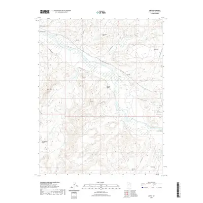
2020 Map of Aneth
USGS Topo · Published 2020About this map
The San Juan River defines the heart of this landscape in San Juan County, Utah, where its winding path creates a vital corridor through the arid terrain of the San Juan Valley. Near the settlement of Aneth, the confluence with McElmo Creek marks a significant geographical junction. Local history is anchored by the Aneth Area Burials Cem and the Ismay Trading Post Rd, reflecting the long-standing cultural and commercial connections of the region. Distinctive geological landmarks like Lone Mtn, Black Rock Point, and Lightning Rock rise above the surrounding flats and canyons, providing natural orientation points. The map also detailes agricultural activity at the 1000E Lone Mountain Farm and scattered water sources such as Sandy Spring and Rockwell Spring, which are essential features in this high desert environment.
Find a feature on this map
37 named features on this map. Tap any name to fly to it.
Don’t see what you’re looking for? This feature index may not catch every label — zoom into the map to look around manually.
Map Details
Editions of this 2020 Aneth Map
This is the sole edition of this map. No revisions or reprints were ever made.
Other maps of this area

1886 · Abajo
USGS Topo · 1:250,000

1892 · Abajo
USGS Topo · 1:250,000

1893 · Abajo
USGS Topo · 1:250,000

1956 · Cortez
USGS Topo · 1:250,000

1958 · Cortez
USGS Topo · 1:250,000

1958 · Aneth 1 SW
USGS Topo · 1:24,000
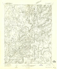
1958 · Aneth 1 SE
USGS Topo · 1:24,000

1958 · Cajon Mesa
USGS Topo · 1:62,500

1959 · Cortez
USGS Topo · 1:250,000

1962 · Cortez
USGS Topo · 1:250,000